
1 / 5
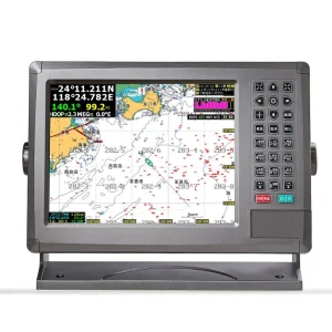
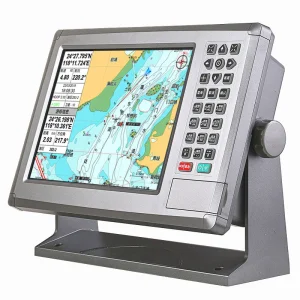
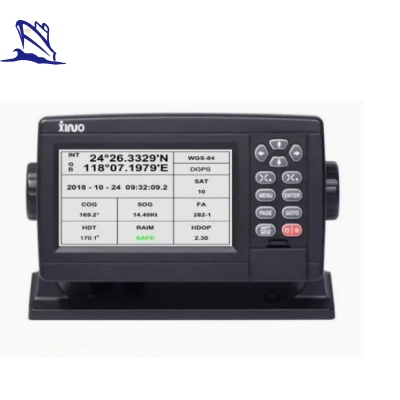
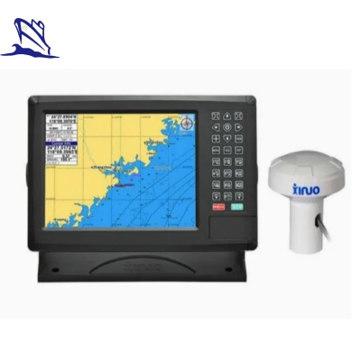
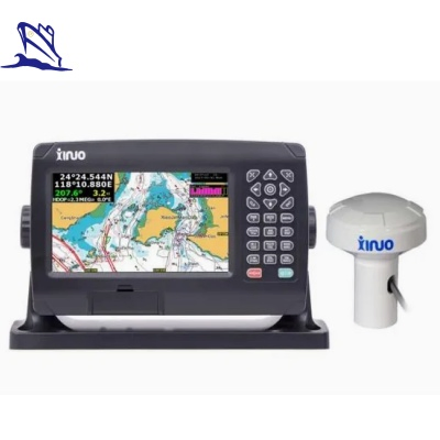
The XF808 marine GPS navigator is a high-performance navigational tool designed for precision and reliability. It supports classic and utility dual-operating systems, allowing users to switch freely based on their needs. The device is equipped with an intelligent voice broadcast system for operation guidance and alarm contents, ensuring safe navigation even in demanding conditions.
Featuring a built-in class B AIS module, it can display information for up to 2000 ships. The AIS radar page provides an intuitive visual representation of ship distribution and various statistical data. Advanced features include fleet management, CPA alarms with an intelligent calculation mechanism to avoid ineffective warnings, and support for online software updates. Its versatile design supports multiple installation methods, including counter and flush mounting.
| Category | Specific Parameters |
|---|---|
| Display System | - Screen Size: 8-inch color TFT LCD - Resolution: 800×480 pixels - Brightness: 450cd/m³ - Display Modes: Standard chart, Pure chart, Simple chart, AIS data, GNSS, 3D navigation, Compass, etc. - Languages: English, Chinese, Vietnamese, Malay, Turkish, Thai, Greek, Indonesian, Japanese, Korean, Spanish, Burmese, Persian, etc. |
| Positioning System | - Mode: BDS and GPS dual-mode high-precision positioning - Frequencies: GPS L1 (1575.42MHz); BDS B1 (1561.098MHz) - Channels: 72 channels - Accuracy: 2.5m (GPS & BDS), 5m (Single mode) - Speed Accuracy: 0.1m/s - Time to First Fix: Cold start < 30s, hot start < 1s |
| Memory & Storage | - Capacity: 50,000 waypoints, 50,000 markers, 500 routes (200 waypoints/route), 1000 tracks, 1,600,000 track points |
| Interfaces | - NMEA 0183: 2 output ports, 2 input ports (independent baud rate) - WiFi: Supports 802.11b/g/n |
| Power & Physical | - Voltage: DC 10V~36V - Consumption: ≤ 8W (at 24V DC) - Waterproof: IP65 - Operating Temp: -15ºC to +55ºC |
| Certifications | - EU CE, ROHS compliant - Standards: IMO Resolution A.694(17), IMO MSC 112(73), IEC 61108-1, IEC 61162-1, IEC 60945 |